Drifter
Modular sensing buoy for acoustic listening, drift mapping, and civic oceanography.
Distributed Drift Infrastructure
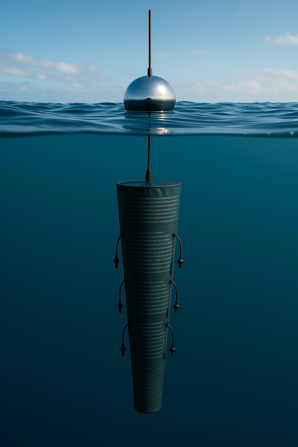
Drifter is conceived as a floating sensing device operating within the open waters of the Central Mediterranean. This maritime region functions as one of the most complex logistical corridors in Europe, where environmental forces, shipping routes, surveillance infrastructures, and humanitarian operations intersect. The project introduces a small autonomous buoy designed to inhabit this space as a minimal infrastructural presence, capable of recording environmental parameters, positional data, and communication conditions across a distributed network.
Unlike conventional oceanographic buoys, Drifter is not anchored to a fixed coordinate. The device is designed to move with the sea, responding to currents, wind forcing, and wave interaction. This mobility allows the system to operate as a drifting observational node, generating a continuous trace of environmental conditions and maritime dynamics. Rather than treating drift as instability, the project considers it a methodological condition. Movement becomes a way of understanding how infrastructures behave when exposed to fluid territories where measurement, communication, and control remain partial and constantly shifting.
The map visualises a hypothetical constellation of these devices operating simultaneously within the region. Each node functions as an independent sensing unit while contributing to a distributed network capable of relaying environmental information, signal conditions, and positional data across open water. The configuration suggests how small-scale autonomous devices could generate a lightweight observational layer over maritime environments without relying on centralised monitoring infrastructures.
No events yet
The constellation map is live again: node visibility, presets and connection behaviour now update in place while the full simulator continues toward a broader desktop release.
After the Map
The prototype is built around a low-power sensing architecture designed to operate under real environmental constraints. Each buoy integrates positioning sensors, atmospheric and marine measurements, and short-range communication modules capable of exchanging signals with nearby nodes. A microcontroller manages local processing and energy usage, while solar-assisted batteries provide the minimal power required to sustain intermittent transmission cycles. Instead of maintaining continuous connectivity, the system prioritises periodic communication bursts, reducing energy consumption and bandwidth dependency.
Data processing occurs primarily at the edge of the system. Environmental measurements and positional signals are filtered locally before transmission, ensuring that only essential information circulates through the network. This approach reduces data accumulation and avoids reliance on permanent cloud infrastructures. Communication between nodes can occur through low-power radio links or satellite uplinks depending on environmental conditions and signal availability. The result is a flexible communication topology in which each device can operate independently while still contributing to a larger distributed network.
Within this framework, Drifter explores how maritime sensing infrastructures might be redesigned using modular hardware, open communication protocols, and decentralised processing models. Rather than replicating large-scale monitoring systems, the project investigates whether smaller autonomous devices can provide meaningful environmental observations while maintaining low operational cost and reduced technological footprint. The buoy therefore functions both as a working prototype and as a model for lightweight sensing architectures capable of inhabiting dynamic maritime environments.
Technical Specs and Operational Notes
The full technical rider and operational notes for Drifter now live in the studio documentation.
Firmware v1
PCB design
Tank tests
Calibration #1
Sicilian Channel
Live telemetry
Real vs OpenDrift
Dataset #2
SOS Méd. archive
PWA launch
Open dataset
CNR/INGV onboard
| Trimestre | Fase | Deliverables | Deploy |
|---|---|---|---|
| T2 2026 | Hardware R&D |
Firmware v1
PCB design
BOM finalized
GPS u-blox M10 integration
LoRa 868 MHz stack
|
- |
| T3 2026 | Prototyping |
3× prototype units
Tank test protocol
IP68 validation
Calibration dataset #1
Iridium 9603 uplink test
|
- |
| T4 2026 | First deployment |
3 drifters in water
Sicilian Channel
Live telemetry dashboard
CMEMS drift comparison #1
SeaCommons API integration
|
▲ DEPLOY |
| T1 2027 | Field calibration |
Real vs OpenDrift delta analysis
Model correction loop
Calibration dataset #2
CNR/INGV contact
|
- |
| T1–T2 2027 | Camargo / Cassis |
Camargo Foundation residency
SOS Méditerranée archive
Model validation on historic SAR
SeaCommons PWA launch
24 Feb – 5 May 2027
|
▲ FIELD |
| T3–T4 2027 | Scale |
Batch 10 production
Open dataset v1.0
CNR / INGV onboarding
MRCC pilot agreement
|
- |